Good Tuesday bloggers,
If your yard or farm is drying out, we understand. In KC we have seen about 60% of our average rainfall the last 30 days. A few locations that received the heavy rain on May 28th are closer to average. It is really drying out across southern and western Kansas where there is a developing drought. So, a pattern that brings more widespread rain and thunderstorms would be nice. This type of pattern is around the corner. Let's go day by day through Father's day and do our best to time out the rain.
TUESDAY: Cumulus clouds will increase and a few may become cumulonimbus clouds. In other words we may see a few showers and thunderstorms this afternoon and evening. If you get underneath one you may see a quick .05" to .25", a temperature drop to the 70s and even more humidity. It would last 5-15 minutes. Otherwise, it will be partly cloudy, hot and humid with highs around 90.
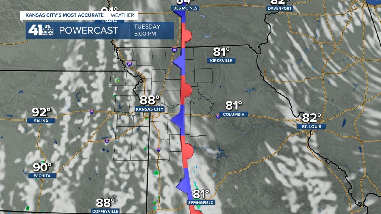
WEDNESDAY MORNING: We have had this north-south front stalled over Missouri the last few days. It has been separating the very warm and humid air to its west and much more comfortable air to its east. Tomorrow morning the front will be rather close. We will see lows again around 70, but look at Columbia, MO. The lows will be in the mid 50s! The comfortable air may be just a 20-50 mile drive east on I-70 from KC.
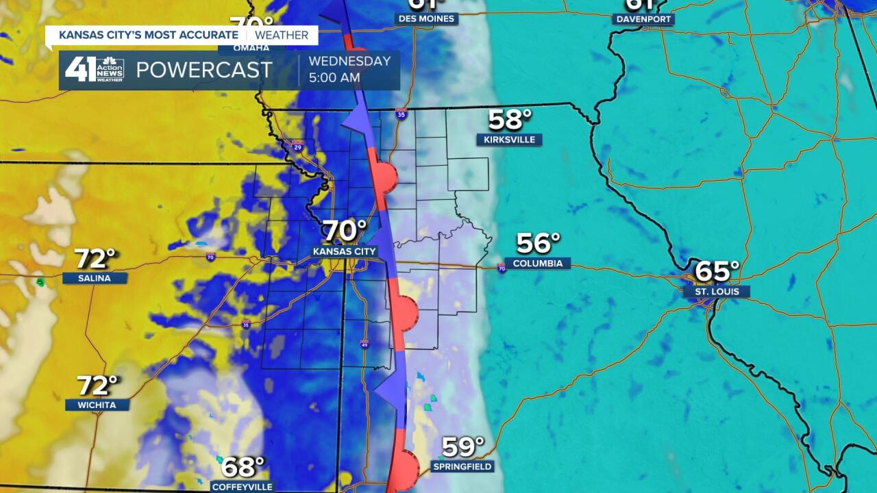
WEDNESDAY AFTERNOON: The front will drift east so we will see highs once again around 90. An isolated shower or thunderstorm is possible early in the morning and again later during the afternoon and evening. A south breeze 10-20 mph will help alleviate the heat and humidity a bit.
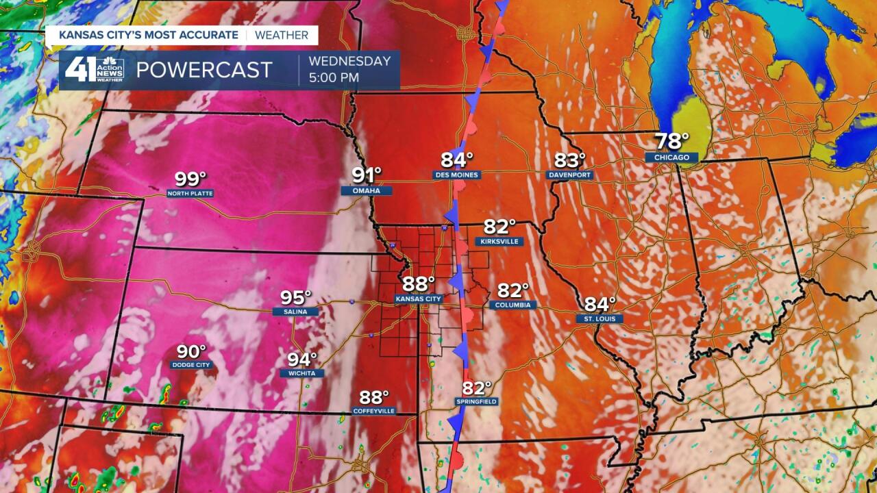
THURSDAY: It will breezy, hot and humid with highs 90-95. But, the change begins on this day. A cold front will be found to the west and northwest. This will be the trigger for more widespread thunderstorms. It looks like the main thunderstorms will form from central Kansas to western Iowa during the afternoon and evening.
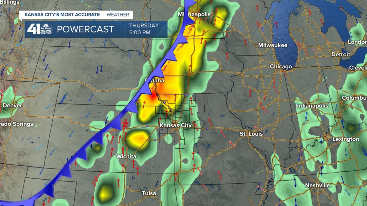
THURSDAY NIGHT: The flow aloft will allow the thunderstorms to roll in here Thursday night. The severe threat is low, but we could see some very heavy rain and even flash flooding in a few locations. This time of year you can go from "I sure could use some rain on my yard/farm" to "Turn off the faucet, I have had too much" in less than an one hour.
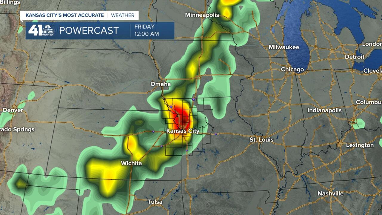
FRIDAY: There will be more areas of rain and thunderstorms as the front from Thursday night stalls and waits for a new system and front from the west. This map is good news to slow the growing drought in the western Plains. We will have a chance for 1-2 periods of rain and thunderstorms. Highs will be in the 80s, but the humidity will remain high.
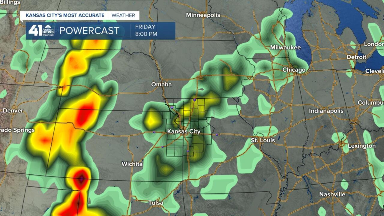
SATURDAY: There will be a chance of rain and thunderstorms Friday night into Saturday. As you can see the system from the western Plains Friday is in Iowa. As it moves east, it should take the rain with it. So, the best chance of rain on Saturday appears to be during the morning and early afternoon. Highs will be in the 80s and the humidity may briefly drop before returning Sunday.
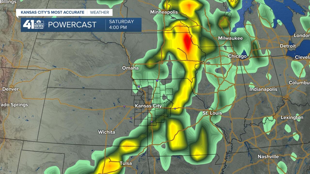
FATHER'S DAY: It looks like most of this day will be dry before the next good chance arrives Sunday night into Monday. Highs will be in the 80s with lows in the 60s.
The next 7 days should see 1" to 4" of rain for most locations. The higher amounts are very hard to pinpoint more than a few hours in advance as it is solely dependent on thunderstorm location.
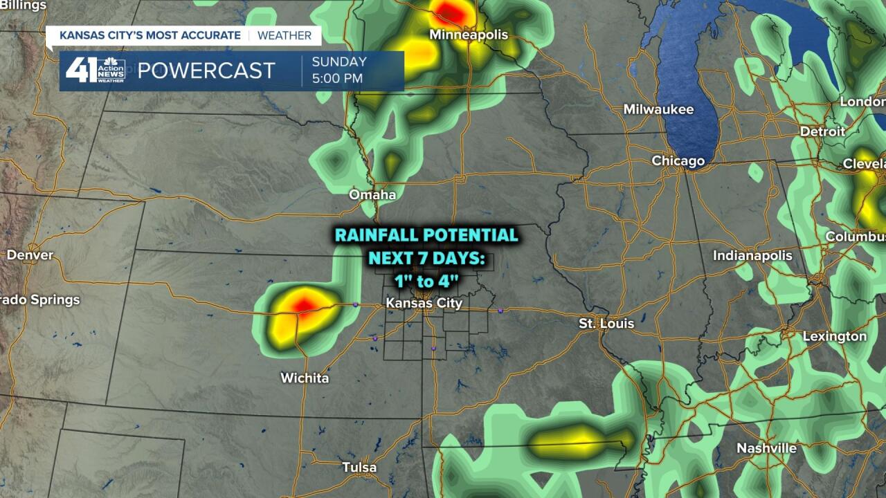
If you do not get enough rain the next 7 days, there will be more chances into early July as the pattern will stay active.
Have a great rest of your week. Stay cool and healthy.
"day" - Google News
June 17, 2020 at 12:39AM
https://ift.tt/2BgSMnr
Weather Blog: Day by Day to Father's Day - KSHB
"day" - Google News
https://ift.tt/3f7h3fo
https://ift.tt/2VYSiKW
Bagikan Berita Ini


0 Response to "Weather Blog: Day by Day to Father's Day - KSHB"
Post a Comment